








US only country voting against UN resolution backing new world map
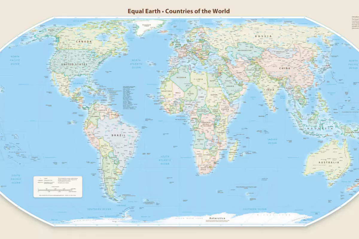
A years-long campaign to change the world's default map came to a vote at the United Nations General Assembly this week, with 164 countries backing a resolution promoting the use of the Equal Earth cartographic projection, while Washington stood firm against it.
The UN resolution was spearheaded by several African countries and calls the Equal Earth projection a format that "offers a more accurate representation of the sizes of continental landmasses and to this end is a relevant option for improving the accuracy of the cartographic representation of the world."
The resolution does not ban the Mercator projection, which remains widely used today, or mandate a replacement. Instead, it encourages governments, schools, international organisations and technology companies to use Equal Earth and other so-called equal-area projections when relative landmass size is important. It also calls for greater awareness of the limitations of flat maps in representing a spherical planet.
The United States was the only country to vote against the resolution on September 4, dismissing the initiative as part of a “radical ideological project.” Six countries – Estonia, Georgia, Lithuania, Moldova, Serbia and Ukraine – abstained.
Colonial background
Behind what may appear to be a technical debate lies a broader argument over history and power: whether a map designed for European sailors in the 16th century has, over generations, distorted not only geography but perceptions of an entire continent.
“Maps shape our understanding of the world,” Togo’s Foreign Minister Robert Dussey said before the vote. “They guide education, nourish the imagination, and influence collective perceptions.”
Dussey argued that the widespread use of the Mercator projection was a legacy of colonisation, adding, "The world is changing. Africa also is changing."
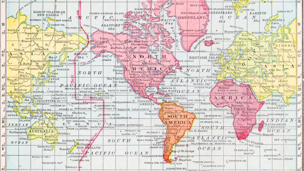
The resolution promotes Equal Earth as an alternative to the traditional Mercator projection, created in 1569 by Flemish cartographer Gerardus Mercator.
The Mercator projection preserves the shapes and angles of landmasses, making it useful for navigation, but significantly distorts their relative sizes. Areas closer to the poles appear much larger than they actually are, while regions near the equator appear comparatively smaller.
As a result, Greenland can appear roughly comparable in size to Africa, even though Africa is about 14 times larger in land size.
France, which co-sponsored the resolution, said it would also move away from using the Mercator projection.
In the Mercator projection, "the United States, Russia and China take on a disproportionate visual prominence compared to Africa, Latin America or Southeast Asia," while "Greenland appears almost as big as Africa," French Foreign Minister Jean-Noel Barrot said in a statement.
"Changing maps obviously doesn't change the world," he acknowledged. "But correcting a distorted representation is already an act of truth."
The UN General Assembly resolution is not legally binding and "in no way challenges the use of Mercator projection for maritime and aerial navigation, for which it remains fully suited," the French Foreign Ministry said.
All the while, the United States criticised the initiative ahead of the vote. "Instead of focusing on genuine problems[...] this body is debating map projects from the 16th century and their role in promoting reparations and cognitive justice," US representative Yaryna Ferencevych blasted.
A comparison of how the two cartographical depictions differ from each other can be found here.
By Nazrin Sadigova







 editor@caliber.az
 +994 55 444-88-98
 Азербайджан, Баку, ул. Низами, 203, Af Business House, 5-й этаж