


Newspaper: Türkiye's maritime map gets UNESCO nod, sparks Greek backlash
Türkiye has secured international recognition for its Maritime Spatial Planning (MSP) in the Aegean Sea, a move hailed by Ankara as a significant step in asserting its maritime rights but sharply criticised by Greece as a provocation.
The Turkish MSP was coordinated by the Ankara University National Research Centre for Maritime Law (DEHUKAM) and has been officially registered on the MSPGlobal platform of the Intergovernmental Oceanographic Commission (IOC) under UNESCO, Caliber.Az reports, citing Daily Sabah.
The plan, now publicly accessible, outlines designated zones for various maritime activities — ranging from fishing and sea transport to tourism and renewable energy — in Turkish waters of the Aegean and Eastern Mediterranean.
According to DEHUKAM Director Mustafa Başkara, the project is part of Türkiye’s wider “Blue Homeland” strategy, which seeks to safeguard and assert control over the country’s territorial waters. Başkara called the recognition a “milestone,” adding that it lays the groundwork for future efforts to enhance Türkiye’s maritime governance and sustainable marine resource use.
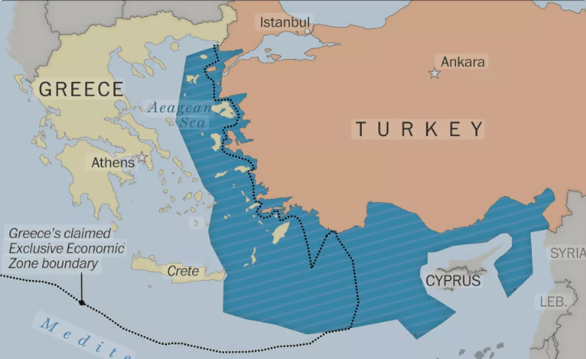
However, the registration of the Turkish plan has provoked a harsh response from Greece, which accuses Ankara of overstepping into areas that fall within Greek jurisdiction. Greek officials argue the plan lacks legal standing and encroaches on waters claimed by Athens. Maritime spatial plans define where activities, including fishing, sea transport, tourism, aquaculture and renewable energy projects, can take place.
In response, Greece has warned that it will take "appropriate action in all international fora" to counter what it sees as Türkiye's unlawful assertions. Greek authorities have also accused Ankara of attempting to undermine Athens’ own maritime sovereignty, particularly in light of a recent Turkish protest against Greece’s plan to establish a marine park in the Aegean — a move Türkiye says risks creating a “fait accompli” in disputed areas.
Despite the flare-up in tensions, both countries are expected to resume high-level bilateral discussions under an existing framework aimed at easing long-standing disputes. The next meeting is set to take place in Türkiye.
Notably, Greece itself only submitted its maritime spatial plan to the European Union in April, citing geopolitical sensitivities as a reason for the delay — a point that had previously drawn criticism from the European Commission.
Türkiye, for its part, insists that its MSP map complies fully with European Union standards, international obligations, and the United Nations Convention on the Law of the Sea (UNCLOS).
By Tamilla Hasanova


 editor@caliber.az
 +994 55 444-88-98
 Азербайджан, Баку, ул. Низами, 203, Af Business House, 5-й этаж