


Ukrainian forces liberate much of Kupiansk Maps
Ukrainian troops have advanced in the Kharkiv region, reclaiming large parts of Kupiansk, according to an analysis by the Institute for the Study of War (ISW), which cites geolocation data.
Analysis of recent geolocated footage shows Ukrainian forces moving along the P-07 Kupiansk–Shevchenkove highway and the P-79 Kupiansk–Chuhuiv route in central Kupiansk.
“ISW has observed ample geolocated footage in recent weeks indicating Ukrainian advances near and within Kupiansk — in line with statements from Ukrainian officials about Ukrainian successes in the area,” the report notes.
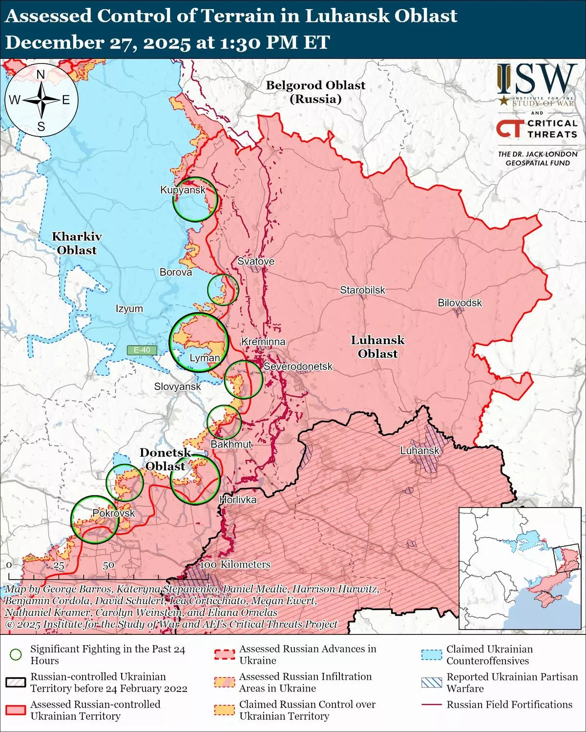

Ukrainian forces continue clearing northern districts of the city and now control most of the local railway junction, a strategic hub affecting logistics across the entire eastern front.
The ISW report adds that Russian military bloggers have begun acknowledging Ukraine’s successes, while sharply accusing the Russian Ministry of Defence of misreporting the progress of Russian forces. Analysts suggest Moscow is intensifying efforts to conceal setbacks in Kupiansk to avoid weakening its position in ongoing peace negotiations with the United States.
"The scale of available open-source evidence of Ukrainian advances in the Kupiansk direction, coupled with the uncharacteristically high number of corroborating reports from Russian sources who do not typically discuss Ukrainian battlefield successes, seriously undermine the Kremlin’s cognitive warfare effort that aims to paint a Russian military victory as inevitable and Ukrainian defences on the verge of collapse," the ISW said.
By Khagan Isayev


 editor@caliber.az
 +994 55 444-88-98
 Азербайджан, Баку, ул. Низами, 203, Af Business House, 5-й этаж