


Artemis mission’s recreated Earth image highlights rapid climate change PHOTO
The iconic “Earthrise” photograph, taken during the Apollo 8 mission in 1968 of our planet from the moon's perspective, has long shaped how humanity sees its place in the universe.
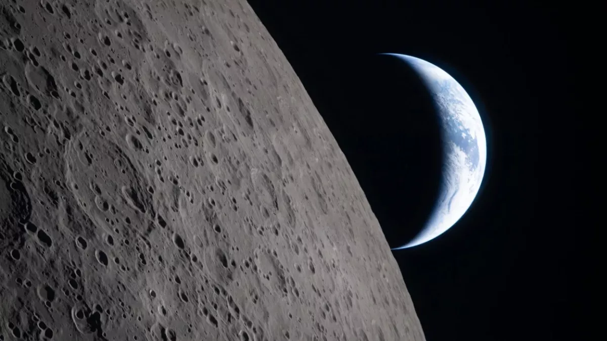
Now, astronauts aboard Artemis II have recreated that historic moment, capturing a new image—dubbed “Earthset”—that highlights how much our planet has changed in just over half a century due to man-made impacts.
The original image was taken by William Anders, as the spacecraft orbited the Moon. Mission commander Frank Borman later described the stark contrast between the lifeless lunar surface and the vibrant Earth.
"The lunar surface was terribly distressed with meteorite craters and volcanic residue," he said in a BBC interview.
"It was either grey or black or white – there was absolutely no colour on the lunar surface, and it was messed up beyond belief." "We looked up and there was the Earth in the background coming over the lunar surface, and Bill Anders took the picture that became probably one of the more significant pictures that humans have ever taken," Borman added.
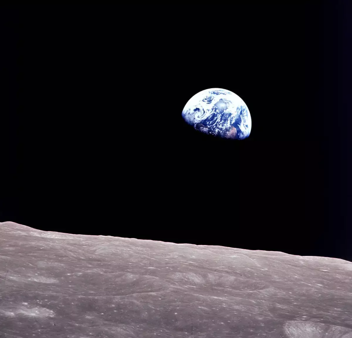
"The Earth was the only thing in the entire Universe that had any colour, it was a remarkable sight – we're very, very fortunate to live on this planet." That image, placing Earth against the stark emptiness of space, helped inspire the modern environmental movement and contributed to the launch of Earth Day in 1970.
During their recent lunar flyby, the Artemis crew captured a modern counterpart. While the timescale between the two images is negligible in geological terms, scientists say the differences reflect significant human-driven changes to the planet. According to climate researcher Richard Allan, atmospheric carbon dioxide levels have risen by about a third since 1968, while global temperatures have increased by at least 1°C.
Human activity has reshaped the planet’s surface, from expanding cities to deforestation and the dramatic shrinking of inland water bodies such as the Aral Sea between Kazakhstan and Uzbekistan.
Some of these changes are even visible from space. Benjamin Wallis notes that Antarctica appears in both images and tells a striking story of environmental transformation. The Antarctic Peninsula, one of the fastest-warming regions on Earth, has lost around 28,000 square kilometres of ice shelf since the original photo was taken.
These shifts are part of broader changes across the planet’s cryosphere. Petra Heil explains that both hemispheres have seen sharp declines in seasonal sea ice, while regions across North America and Eurasia now experience shorter snow seasons, with later formation and earlier melting. "I think we are pretty confident based on the observations but also the numerical models to assign probably 90-95% of the change to human activities," Heil warns.
By Nazrin Sadigova


 editor@caliber.az
 +994 55 444-88-98
 Азербайджан, Баку, ул. Низами, 203, Af Business House, 5-й этаж