


POLITICS
A+
A-
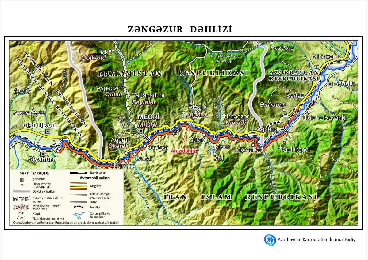
Zangazur Corridor map published highlighting key settlements, routes
14 October 2025 20:03
The Public Association of Cartographers of Azerbaijan has unveiled a new map of the Zangazur Corridor.
Mugabil Bayramov, chairman of the union, said the map was developed using high-resolution satellite imagery, Caliber.Az reports.
It details relevant areas of both Azerbaijan and Armenia, marking settlements, roads, rivers, and mountains.
The map also highlights the Aras Corridor and the adjacent territory of Iran. It has been published in both Azerbaijani and English.
By Aghakazim Guliyev
Caliber.Az
Views: 1952


 editor@caliber.az
 +994 55 444-88-98
 Азербайджан, Баку, ул. Низами, 203, Af Business House, 5-й этаж